


🌍 Adventure Awaits: Your Ultimate GPS Companion!
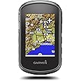
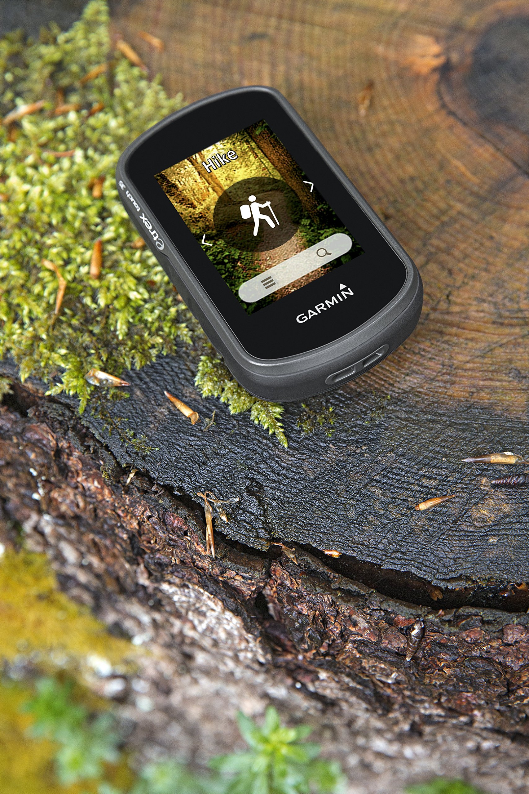
The Garmin Trex Touch 35 is a versatile handheld GPS designed for outdoor enthusiasts, featuring a 2.6-inch touchscreen, preloaded maps, and smart notifications, all packed in a lightweight design perfect for cycling, hiking, and geocaching.


| Department | Adult (Unisex) |
| Manufacturer | Garmin |
| Item model number | 010-01325-11 |
| Product Dimensions | 5.8 x 3.3 x 10.2 cm; 159 g |
| ASIN | B010UPWVGU |
| Guaranteed software updates until | unknown |
M**N
AA battery use is so convenient
Its so long since I used a device that just took regular batteries, AA battery use is so convenient. This device packs in a ton of features an excellent value package for anyone that spends time outdoors and has an interest in tracking location information. hiker walker biker photographers fishing all sorts of outdoor activities. I used to use my phone for tracking but always struggled with battery life, now my phone lasts all day and the etrex just takes AA batteries so can be swapped out as needed but easily lasts all day and more on a pair.
D**M
Etrex Touch 35 or 25 - be aware of the connectivity limitations...
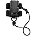
The eTrex Touch 25 and 35 are very similar units. The hardware looks pretty rugged, and it looks like it would withstand a reasonable amount of knocking around on a trail (maybe buy a screen protector though). Both come with bike mounts which seem to hold the device quite securely. The software is designed so that you can set up a number of profiles for different sports such as cycling or hiking and adapt the settings to suit your needs for each sport. I'm not sure I 'get' what this is all about at the moment, maybe it will be useful in the future, but so far I've been using mine on the simpler 'classic' setting, which seems more intuitive to me. I first bought a 25, believing it had bluetooth connectivity, so that I could plan a route on my phone and send it wirelessly to the GPS. You can do this planning on a computer and plug the unit in to the computer using the supplied cable, which is fine, but if we're away on holiday for a couple of weeks we won't have the computer with us. Hence why I wanted to use my phone to plan a route. (You could technically plan the route directly on the GPS unit but frankly its such a fiddle that personally I wouldn't bother). Unfortunately the 25 does NOT have bluetooth, so I returned it and exchanged it for the 35 model, which does have bluetooth, and a couple of additional features such as a barometric altimeter, and the ability to connect other sensors for a few pounds extra. The 35 arrived and was all set up and bluetooth paired with my phone easily. Great. Except (and this is not made clear by Garmin IMHO), the buetooth can only be used to relay text messages from your phone to the GPS, or to upload activities after you have done them to the Garmin Connect app. You cannot use bluetooth to send a route wirelessly from your phone to the GPS. Why this is the case I have no idea, as it is possible on some other more expensive Garmin models, and to me it seems a pretty basic requirement. I have found that there is a 'work around' (which I suspect would probably work on the 25 as well, although I didn't try it). It turns out that if you connect the GPS to a reasonably new Android phone using an 'on the go' connector cable, you can plan the route, and send it that way to the GPS. You need to be a bit savvy about transferring files, but there are on-line guides about how to do it. I found it easiest to put a micro SD card in the GPS (max 32GB) and transfer the routes to the correct Garmin folder on that. So, it can be done, but it's certainly not the seamless wireless transfer that I was hoping it would be. Other than this, I'm pretty happy with the eTrex. Hope this helps...
G**N
Great GPS unit.
I love this gps unit. Can't compare it to others as I have never used them before. Very easy to set up and use straight bfrom the box. Loads of features in a small compact unit. map screen is small but is readable. I've used this on a good few walks now and never fails. You won't get lost using this !!!
O**S
Just a massive disappointment!
This is my first ever Amazon review (edit...just realised I'd made couple of minor comments before). Mainly because things are busy but also because everything I have bought before falls inbetween the 'acceptable' to 'very good' bracket. This is a different situation...First off I'm quite 'techy', have no previous experience with GPS units and have no vested interest in anything but honest reviews.So I've been using Alltrails (free) on my mobile for my various outdoor pursuits and fancied an upgrade to a dedicated handheld GPS unit. I did loads of research and eventually settled on the Garmin Etrex touch 35, marketed as a mid range device. I was really excited to recieve it.So it was delivered and I opened the box. First impressions were that it was physically smaller than expected, lightweight and a touch plasticky (Garmin call this rugged). Popped in the 2x AAs and the SD card and powered up. Now I'd been told the included Europe maps weren't that useful but tbh I couldn't believe what I was seeing! The screen is tiny, the resolution simply a joke and the map basic beyond belief. Theres a huge forest 2 miles away and that area was blank. Just the adjacent A road could be seen. Useful for finding london from the M1 i guess if you need that but not much else at all.I'd anticipated this and pre ordered the talky toaster HD UK map in advance. So i loaded that up and was gobsmacked. I'll include pics but it was basically unusable also.The screen is just hopeless. It's a touch screen but not as we know it. You can touch 3 spots to zoom in and out and slowly move the map, but no pinch to shrink etc. And it's so small theres almost nothing to touch anyway. As mentioned the resolution is shameful...comparable to a late 80s computer game or a pre- millennium mobile. I cant believe in 2021 this is the best that Garmin can do.The OS and menus are equally frustrating to use. Way too many steps to perform what I thought would be very simple functions. Also, planning routes both on the unit and through Basecamp is onerous and frustrating.I took the GPS out locally to a rural area and soon got a headache trying to decifer the info on the screen. Again due to the tiny screen I knew I was on a footpath but no idea where...zoomed out and was greeted with a confusing impression of a Jackson Pollock painting.I dont mean to sound so negative...I was really hoping to love this GPS. But I'm returning it as not fit for purpose, for me at least. If my life depended on this in an emergency I'm afraid I'd chuck it off the cliff and take my chances with the stars.So I'll be going back to Alltrails until Garmin catch up to 2021 (or even 2001!) It might drain my battery quickly but I guess a power bank would sort that out.NB. First pic is of alltrails on my mobile.Second is a HD map on the Etrex...which would you choose?
Trustpilot
2 weeks ago
3 days ago